Learning Objectives
After completing this lesson, you’ll be able to:
- Understand where you fit among different kinds of FME users.
- Describe FME users’ industries.
- Describe FME users’ data types.
Video
Who Are FME Users?
People use FME for a variety of reasons. Most of our users fall into one or more of the following categories:
- GIS Technicians: professionals with a background in geography who work entry-level positions in GIS. Their day-to-day tasks include conducting spatial analysis, loading data in and out of GIS databases, and creating maps or GIS applications.
- GIS Experts: mid- or late-career professionals with a background in geography, computer science, or engineering who are highly advanced GIS users working on big cross-departmental projects. They often design the systems GIS Technicians implement and end up working with a wider variety of data types and applications.
- Business Data Analysts: professionals with a background in business analytics who normally work in programs like Excel and business intelligence tools like Qlik, Tableau, or PowerBI. They find value from FME because their data has gotten too big and complex to manage in spreadsheets, and they want to automate the data preparation process.
- Citizen Integrators: professionals with various backgrounds working with data who are trying to reduce their data integration costs and automate everyday tasks. Their solutions are tactical, and they value FME for being able to integrate data and applications quickly.
- Integration Specialists: professionals creating data and application integration solutions at an enterprise level. They often work in an IT department or are a consultant. Their solutions are strategic, and they value FME for creating durable and comprehensive integrations.
Which Industries Use FME?
FME is used by a variety of industries due to its flexibility and ease of use. Not only are 450+ formats supported, but custom content is always being uploaded by community members to FME Hub, which is free to access.
We are in the process of creating scenario-based training content for these industries. In the meantime, check out the industry solutions pages or our Knowledge Base for more information. Interested in taking training for one topic in particular? Let us know with this quick survey.
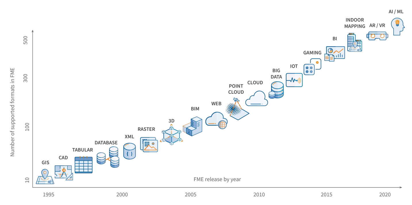
What Data Types Does FME Support?
Similarly, FME supports a wide variety of data types. You can rely on FME to support core data types for spatial data integration, including CAD and GIS. You can also trust that FME will adapt to your rapidly-changing data integration needs, adding widely-used systems and cutting-edge technology.
Check out the data type solutions pages or our Knowledge Base for more information on working with these data types. Interested in training for one data type in particular? Let us know with this quick survey.
Learning Objectives
After completing this lesson, you’ll be able to:
- Understand where you fit among different kinds of FME users.
- Describe FME users’ industries.
- Describe FME users’ data types.
Video
Who Are FME Users?
People use FME for a variety of reasons. Most of our users fall into one or more of the following categories:
- GIS Technicians: professionals with a background in geography who work entry-level positions in GIS. Their day-to-day tasks include conducting spatial analysis, loading data in and out of GIS databases, and creating maps or GIS applications.
- GIS Experts: mid- or late-career professionals with a background in geography, computer science, or engineering who are highly advanced GIS users working on big cross-departmental projects. They often design the systems GIS Technicians implement and end up working with a wider variety of data types and applications.
- Business Data Analysts: professionals with a background in business analytics who normally work in programs like Excel and business intelligence tools like Qlik, Tableau, or PowerBI. They find value from FME because their data has gotten too big and complex to manage in spreadsheets, and they want to automate the data preparation process.
- Citizen Integrators: professionals with various backgrounds working with data who are trying to reduce their data integration costs and automate everyday tasks. Their solutions are tactical, and they value FME for being able to integrate data and applications quickly.
- Integration Specialists: professionals creating data and application integration solutions at an enterprise level. They often work in an IT department or are a consultant. Their solutions are strategic, and they value FME for creating durable and comprehensive integrations.
Which Industries Use FME?
FME is used by a variety of industries due to its flexibility and ease of use. Not only are 450+ formats supported, but custom content is always being uploaded by community members to FME Hub, which is free to access.
We are in the process of creating scenario-based training content for these industries. In the meantime, check out the industry solutions pages or our Knowledge Base for more information. Interested in taking training for one topic in particular? Let us know with this quick survey.
What Data Types Does FME Support?
Similarly, FME supports a wide variety of data types. You can rely on FME to support core data types for spatial data integration, including CAD and GIS. You can also trust that FME will adapt to your rapidly-changing data integration needs, adding widely-used systems and cutting-edge technology.
Check out the data type solutions pages or our Knowledge Base for more information on working with these data types. Interested in training for one data type in particular? Let us know with this quick survey.


